October 13, 2019
Retracing Lena Huppler Bevers’ Travel Log
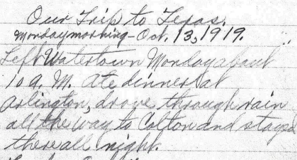
Our Trip to Texas.
Monday morning – Oct.13, 1919.
Left Watertown Monday about 10 A. M. Ate dinner at Arlington, drove through rain all the way to Colton and stayed there all night. – Lena Bevers
Today is Sunday, but 100 years ago October 13 was on a Monday, and about 10:00 AM that day Herbert and Lena Bevers, along with six of their children, began a trip from Watertown, in northeastern South Dakota to the southern Texas town of Raymondville, near the U. S. border with Mexico.
Lena kept a log of their travels and according to her entry, their first destination that day was Arlington, where they ate their mid-day meal (dinner). Arlington was about 40 miles south of Watertown, and their final destination for the day was Colton which was approximately 50 miles south of Arlington. At that time the law regarding driving speed in South Dakota was: “Careful and prudent, having regard to traffic conditions.”1 If we assume that they drove about 6 hours that day, then they were driving about 15 miles per hour.
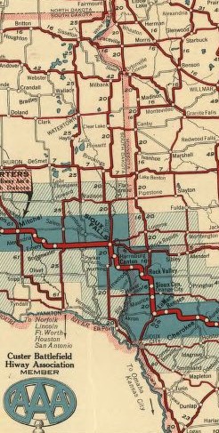
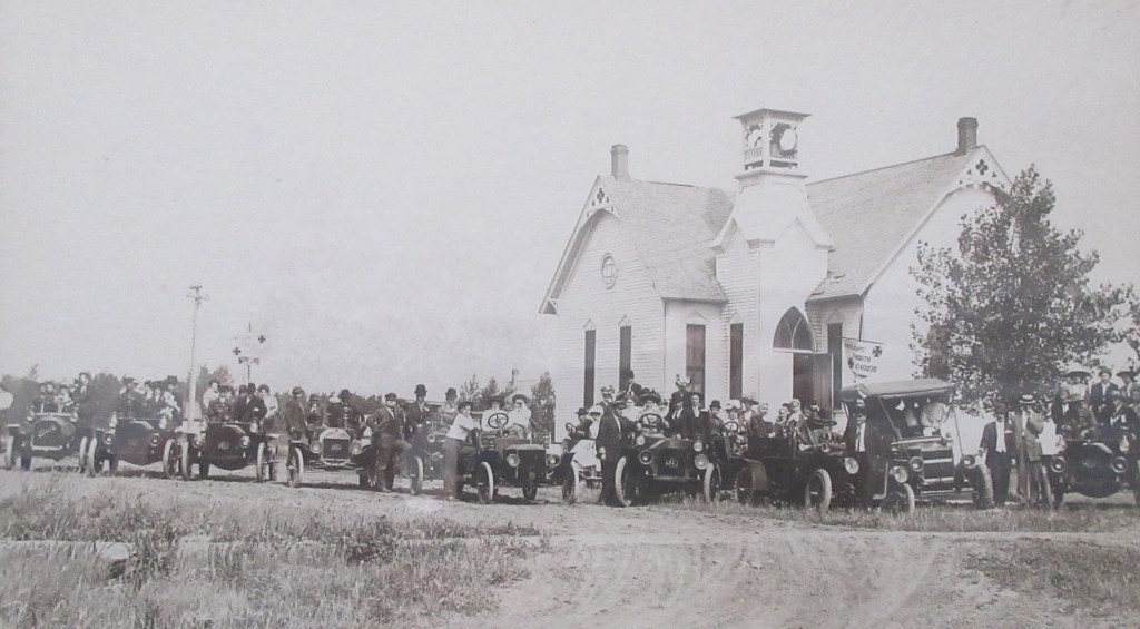
For the next 27 days, my mother and I will attempt to retrace Herbert and Lena’s route. For the first few days, we are going to base our route on a map obtained from the Library of Congress website (https://www.loc.gov/resource/g4126p.mf000065/). It is called the Touring Map of the Custer Battlefield Hiway, dated 1925, and it was published by the National Highways Association, which was incorporated in 1912 in Washington, D. C. Printed on the map is the following statement, explaining the purpose of the association:
“A membership corporation which exists to favor, foster and further the development of NATIONAL HIGHWAYS and GOOD ROADS EVERYWHERE in the length and breadth of these United States of America, and to secure the benefits — social, moral, commercial, industrial, material, educational and personal — in the progress and uplift of the American people which follow in the train of easy intercommunication and transit between the great centers of population and distribution and the great rural productive areas of the Nation, and so ‘bind the States together in a common brotherhood, and thus perpetuate and preserve the Union.'”2
On this map there is a highway with the number 25 (this is not a highway number; it is simply the number associated with the numbering system of the map legend). In the legend this highway is named Meridian Highway. Meridian Highway was a transcontinental highway with starting and ending points of Winnipeg, Manitoba, Canada and Galveston, Texas and Mexico City. Running along the eastern border of North Dakota, this highway entered South Dakota, veered west a short ways, then headed south. Thirty miles north of Watertown, it crossed over the Yellowstone Trail, an east-west transcontinental highway which ran from Plymouth Rock, Massachusetts to Puget Sound, Washington.3 Meridian Highway continued south and passed through Watertown. Currently, from the northern border of North Dakota to Watertown, Interstate Highway 29 and U. S. Highway 81 roughly follow the route that was once called the Meridian Highway. At Watertown, U. S. Highway 81 breaks off from Interstate Highway 29, continuing to follow more closely the original Meridian Highway.
Having had a blustery snow storm on Friday and Saturday, and fearing that we might have to delay our departure for a few hours, my mother checked the weather report on her phone at 6:30 AM this morning. The forecast said there’d be cloudy skies but no snow. The roads did not look icy as well, so my mother and I set out on schedule at 8:00 AM from Watertown on a macadam road. Our journey began on U. S. Highway 81, which presently runs straight south from Watertown to Madison, traveling between Lake Albert and Lake Poinsett, but on the 1925 map after starting south the Meridian Highway took several zigzag turns southwest toward Hayti and then resumed its southernly direction, circumventing Lake Albert on the west side. So, we needed to leave U. S. Highway 81, but we could not determine exactly which roads Herbert drove toward Hayti. We decided to take Highway 21 which took us through Hayti and Lake Norden. We ran into difficulty when we exited Lake Norden because the roads were not marked. A few miles further the road was snow-covered, so we decided to turn back and take a well-traveled route.
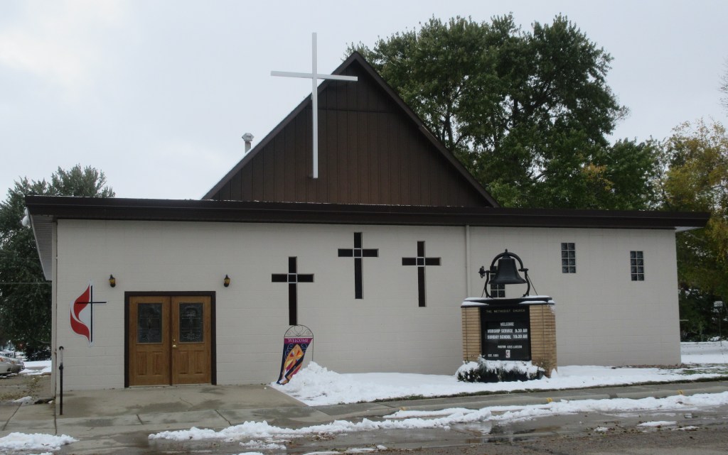
At mid-day Herbert and Lena would have reached a road numbered 7 on the Custer Battlefield map and named the Black and Yellow Trail. This route ran from Chicago to Yellowstone National Park. Here they turned east and drove to Arlington. If they had turned to the west, they would have driven toward De Smet, the town in which Herbert’s father and two sisters lived. Since we can travel more miles in a day than they could, we took a side trip to De Smet and attended the worship service of De Smet United Methodist Church, arriving 10 minutes late because we had to change our route.
De Smet is the town made famous by Laura Ingalls Wilder in her book Little Town on the Prairie. Wilder’s parents homesteaded north of De Smet and came to the town for supplies. The Ingalls family lived in De Smet from 1889 until at least 19244, which overlaps with the time that Herbert’s father, mother and sisters lived in De Smet.
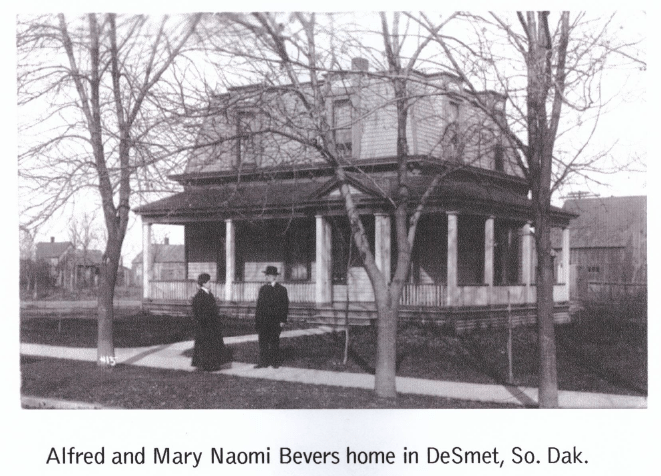
After the church service, the pastor allowed my mother and I to examine four of the church’s early record books. This research confirmed some facts already known and gave us new information about the lives of these ancestors. Alfred C. Bevers and his wife Mary lived their final years in De Smet, beginning in 1898, bringing their daughters Gertrude and Maude with them. An historical article states that Alfred was a retired minister and his family “brought a lot of encouragement to the church.”5 Mary and Gertrude were involved in the Ladies Aid Society. Gertrude and Maude were members of a young adult group called the Epworth League. Maude led the choir for many years. In 1904 Maude married Alfred N. Waters, a real estate agent in De Smet. Mary passed away in 1910. In 1920, a few months after Herbert and Lena traveled down Meridian Highway, Alfred at age 82, was renting a house on 2nd Street and his unmarried daughter Gertrude was living with him.6 Maude and her husband also lived on 2nd Street.
When we left the church, we started searching for the houses of the Bevers and Waters families. The 1920 census records of De Smet list the street name as 2nd street, but there are no street numbers. Although a couple homes seemed familiar to my mother (she had visited her great-aunts Maude and Gertrude as a child), we could not be positive that any of the homes were the ones in which the Bevers and Waters lived.
Then we headed for the De Smet Cemetery. When we were about a mile from the cemetery, the road became slushy so we did not travel any further. At that point we got on Highway 14, heading toward Arlington, the town where Lena and her family had dinner (their mid-day meal.)
Arlington is a town with a population of 915. Finding a place to eat lunch was a challenge. We drove down the two blocks of the main street and found only a bar/grill/bowling alley which was not open on Sundays. Driving about half a mile outside of town, we came to a restaurant that didn’t open until 4:30 PM on Sundays. Nearby was a gas station that advertised subs and pizza in the window, but it also was closed. Then we saw a motel that had a diner, which closed at 1:00 PM and we were there at 1:15 PM. Finally, we were directed to another gas station/convenience store which had a nice selection of sandwiches, burgers, chicken and wieners.
After lunch we took one more side trip to visit my mother’s brother-in-law in Brookings. When we returned to U. S. Highway 81 to resume following Herbert and Lena’s route, we found that the highway was closed and we would have to follow a detour which took us fifty miles out of our way.
At Madison, Herbert and Lena left the Meridian Highway and headed toward Colton where they ended their day. My mother and I wanted to stay the night in Colton, but when we searched online for a motel there, we couldn’t find one. So, we ended our day in Madison, arriving at the motel at 5:30 PM.
Notes:
- Automobile Blue Book Publishing Company, Official Automobile Blue Book 1917, vol. 5 (New York: Automobile Blue Book Publishing Company, 1917): 1235, https://ia800405.us.archive.org/15/items/case_gv1024_a92_1917_vol_5/case_gv1024_a92_1917_vol_5.pdf.
- John C. Mulford and C. C Faunce, Touring map of the Custer Battlefield Hiway: the scenic route to the west, [S.l, 1925] Map. https://www.loc.gov/item/99466708/.
- Yellowstone Trail Association, “Introduction to the Yellowstone Trail,” Yellowstone Trail (2019), http://www.yellowstonetrail.org/page141.html.
- My Genealogy Hound, www.mygenealogyhound.com/vintage-photographs/south-dakota-photographs/SD-De-Smet-South-Dakota-Charles-and-Caroline-Ingalls-House-210-Third-Street-photo.html.
- First Methodist Church, “A History of the Church,” Consecration Service of the Remodeled First Methodist Church (De Smet, South Dakota: First Methodist Church, September 26, 1965)
- “United States Census, 1920,” database with images, FamilySearch (https://familysearch.org/ark:/61903/3:1:33S7-9RND-PYY?cc=1488411&wc=QZJT-TLH%3A1036874501%2C1038378501%2C1038387101%2C1589334506 : 13 September 2019), South Dakota > Kingsbury > De Smet > ED 203 > image 8 of 22; citing NARA microfilm publication T625 (Washington, D.C.: National Archives and Records Administration, n.d.).

What a great start to your trip! We hope that you have a great adventure.
LikeLike