October 25, 2019
Retracing Lena Huppler Bevers’ Travel Log
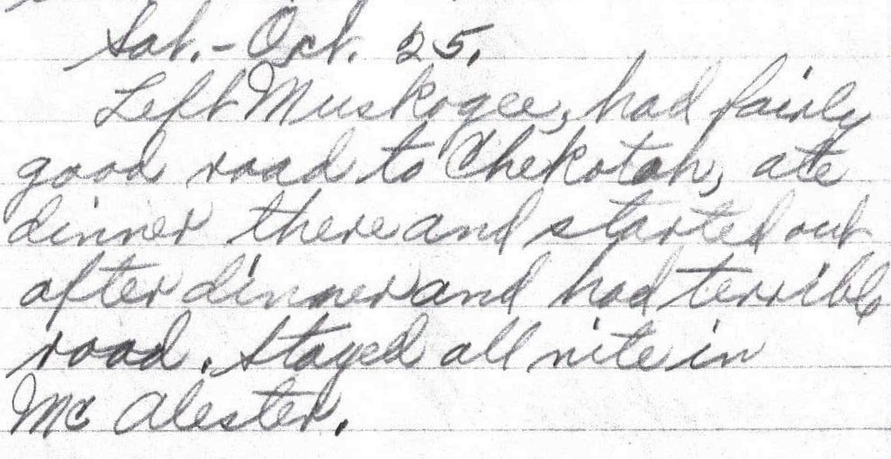
Sat. – Oct. 25.
Left Muskogee, had fairly good road to Chekotah, ate dinner there and started out after dinner and had terrible road. Stayed all nite in McAlester. – Lena Bevers
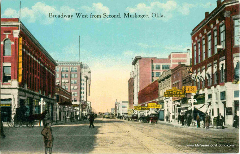
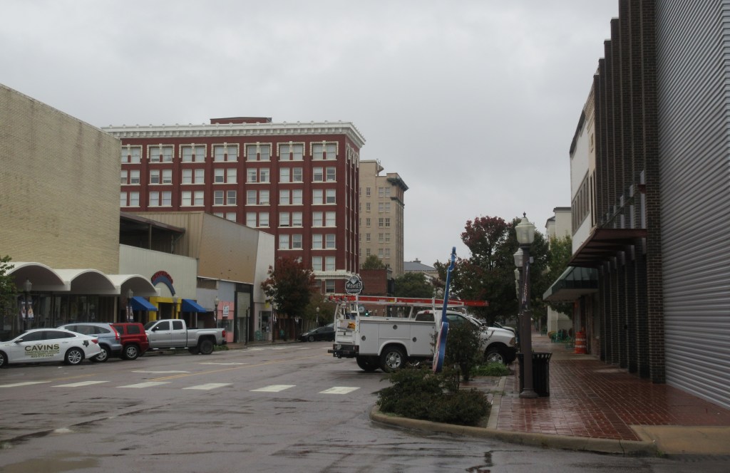
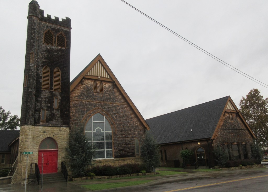
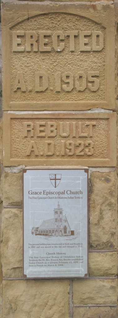
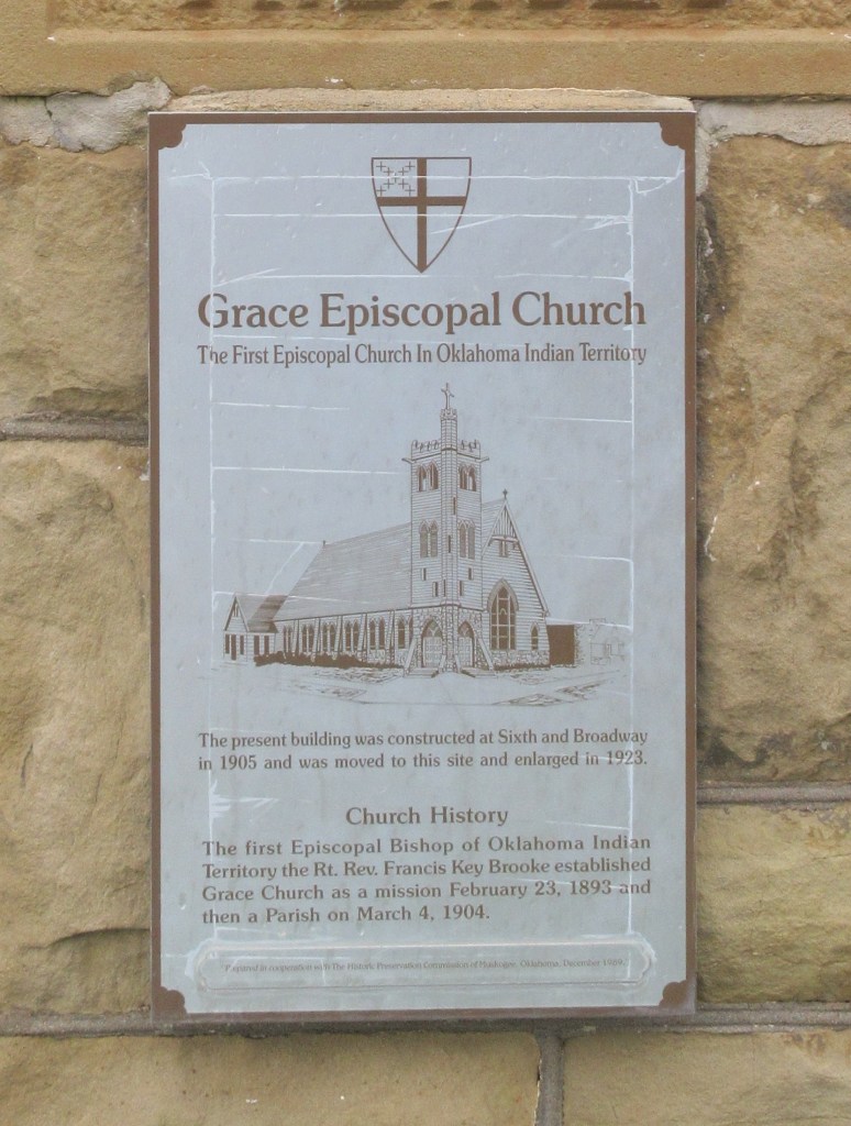
During the century since the Bevers family drove through Muskogee, Oklahoma, many of the buildings seen in the postcard below have been replaced. But in the background on the left side of Broadway, there are two buildings that are still standing and can be seen in the photograph that I took today. The most interesting building we saw was Grace Episcopal Church. It was built in 1905 at 6th and Broadway, then in 1923 it was moved and enlarged at a site a couple blocks away. The siding made of wood shingles was very attractive.
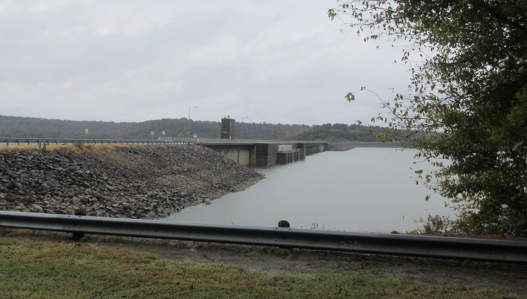
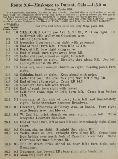
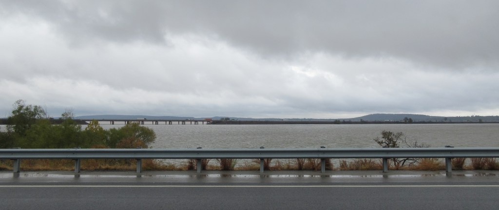
On October 25, 1919 the Bevers family started out following the King of Trails and Jefferson Highways. Referring to Route 916 in The Official Automobile Blue Book 1920, the road is described as mostly graded dirt, with a 5-mile stretch of sandy road near the Canadian River and “some stretches of gravel where old RR grade has been utilized as highway.”2 Lena states that they “had fairly good road to Chekotah, ate dinner there.” To follow Herbert and Lena’s route today, we again headed south on U. S. Highway 69, a divided four-lane highway. At Checotah, we stopped for lunch and filled the car with gas. If the original King of Trails/Jefferson Highway was still in existence today, the following photograph shows what a driver would encounter when he reached about eight miles south of Checotah.
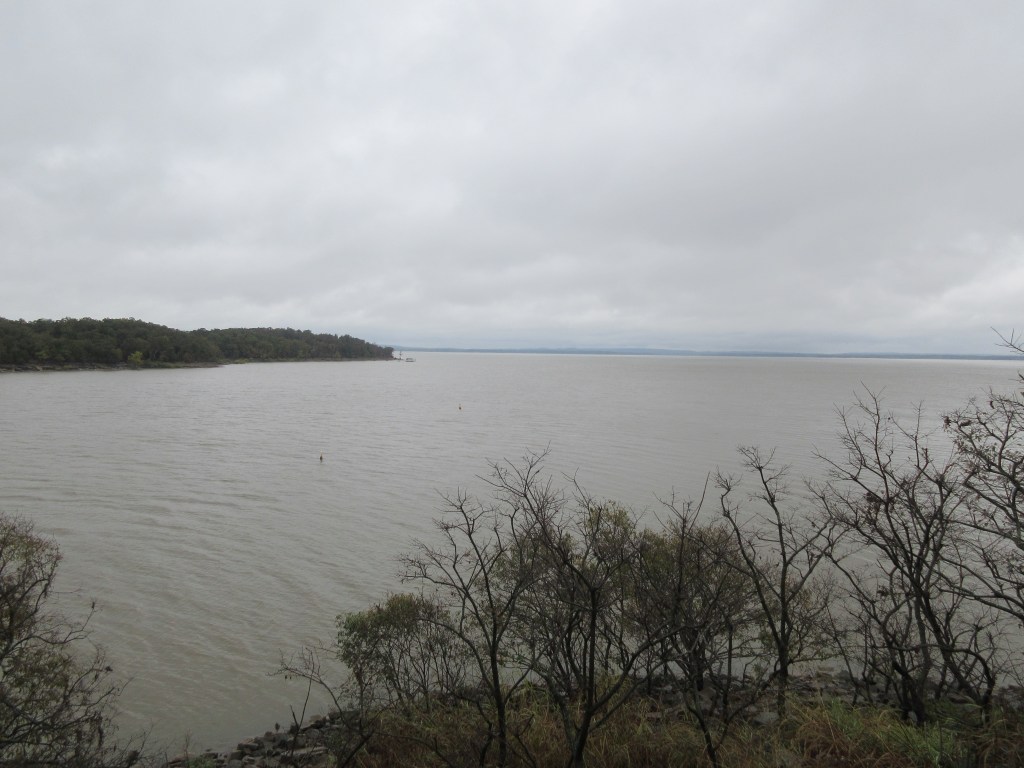
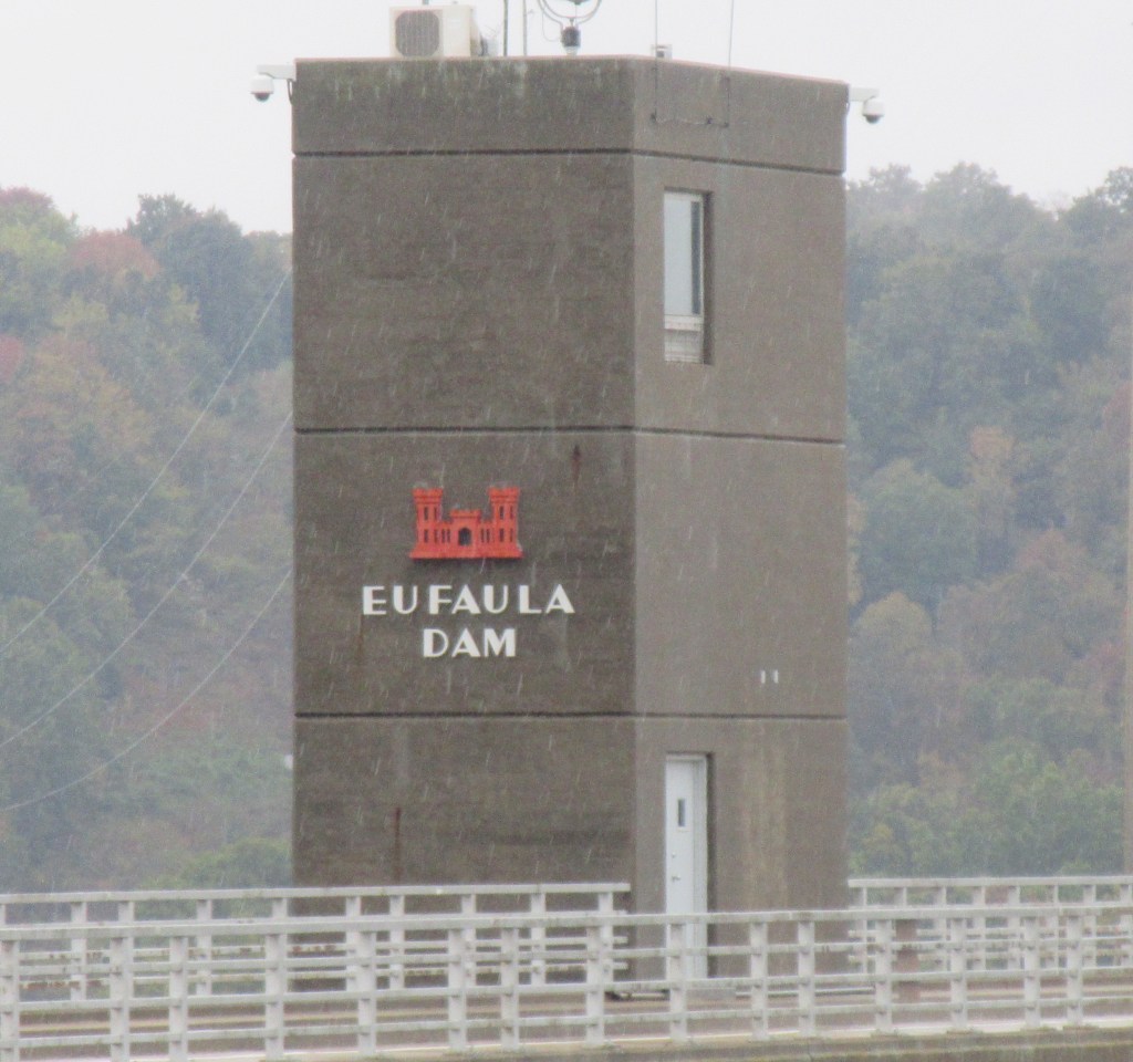
The Eufaula Dam was completed in 1964, creating a reservoir fed by the Canadian River and other rivers. “The [Eufaula Dam] project was authorized by the 1946 River and Harbor Act. It was designed by the Tulsa District, U.S. Army Corps of Engineers, and built under the Corps supervision at a cost of $121,735,000. Construction was started in December 1956 and was completed for flood control operation in February 1964. President Lyndon B. Johnson dedicated the project on September 25, 1964.”3
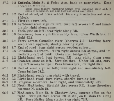
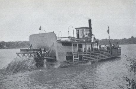
When arriving in Eufaula, a note in the running directions for Route 916 in the 1920 Blue Book tells the reader: “Make local inquiry regarding bridge over Canadian river and, if same is completed, use new highway going over same.”5 Lena and Herbert with their family arrived at this point only a few months before this guide book was published, so they may have had to make this inquiry to determine how to cross the Canadian River. If the bridge was not completed yet, a motorist following the 1920 Blue Book directions would find that about six miles further down the route he would need to cross the Canadian River on a ferry. In fact, this is what Herbert and Lena did, for at the end of Lena’s journal, she makes a final comment, stating that they were “ferried across the Canadian river.”6 The charge for using the ferry was $1.00.7 Below is a picture of a ferry at Boonville, Missouri, dated 1913. Although this isn’t the ferry they utilized, nor is it the location where they were ferried, this photograph gives us an idea of what type of ferry they would have used.
“When the Jefferson Highway was first located through Eufaula the only way of crossing the South Canadian River, about four miles below the town, was by means of a rather uncertain ferry, and the citizens of Eufaula, feeling the great need of a good bridge across the river, incorporated The Jefferson Highway Bridge Company, and at a cost of almost a quarter of a million dollars, built the present splendid structure of steel and concrete, forty feet above low water, affording a 365 day crossing throughout the year. Already the traffic over this bridge, which was opened for use April 21, 1920, bids fair to justify the large expenditure upon it and it is rapidly becoming one of the notable landmarks of the neighborhood.”10
Notes:
- Broadway West from Second, Muskogee, Okla. (ca. 1915-1920): http://www.mygenealogyhound.com/vintage-postcards/oklahoma-postcards/OK-Muskogee-Oklahoma-Broadway-West-From-Second-vintage-postcard.html.
- Automobile Blue Book Publishing Company, The Official Automobile Blue Book 1920, vol. 7 (New York: Automobile Blue Book Publishing Company, 1920): 797, https://ia601208.us.archive.org/26/items/case_gv1024_a92_1920_v_7/case_gv1024_a92_1920_v_7.pdf.
- U. S. Army Corps of Engineers, Tulsa District, History of Eufaula History: https://www.swt.usace.army.mil/Locations/Tulsa-District-Lakes/Oklahoma/Eufaula-Lake/History/.
- Automobile Blue Book Publishing Company, The Official Automobile Blue Book 1920, vol. 7: 797-798.
- Automobile Blue Book Publishing Company, The Official Automobile Blue Book 1920, vol. 7: 798.
- Lena Bevers, Our Trip to Texas (unpublished, 1919): 12.
- Automobile Blue Book Publishing Company, The Official Automobile Blue Book 1920, vol. 7: 798.
- Ferry across Missouri River at Boonville, MO (1913): https://www.fhwa.dot.gov/infrastructure/trgal35.cfm.
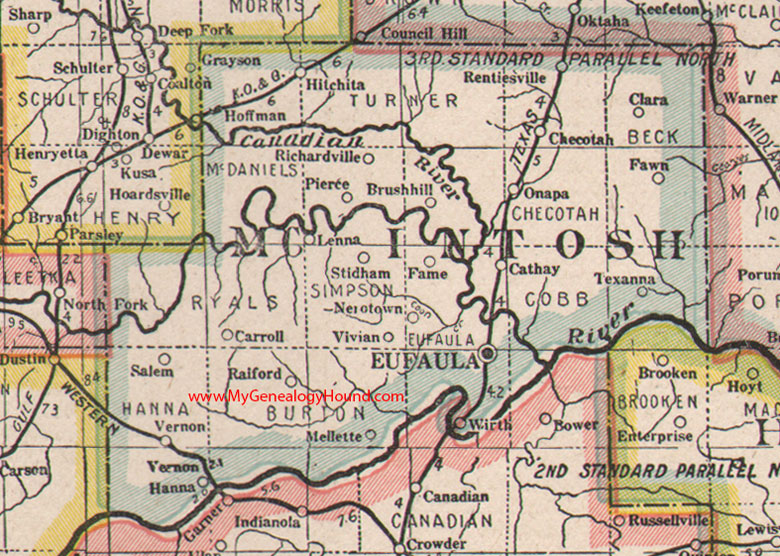
- McIntosh County, Oklahoma 1922 Map: http://www.mygenealogyhound.com/maps/oklahoma-maps/ok-mcintosh-county-oklahoma-1922-map.html#.
- John D. Benedict, Muskogee and Northeastern Oklahoma, vol. 1 (Chicago: The S. J. Clarke Publishing Company, 1922): 500, http://genealogytrails.com/oka/mcintosh/countyhistory.html.
