October 19, 2019
Retracing Lena Huppler Bevers’ Travel Log
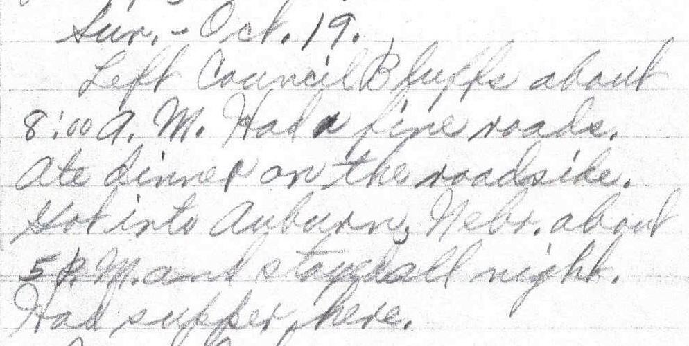
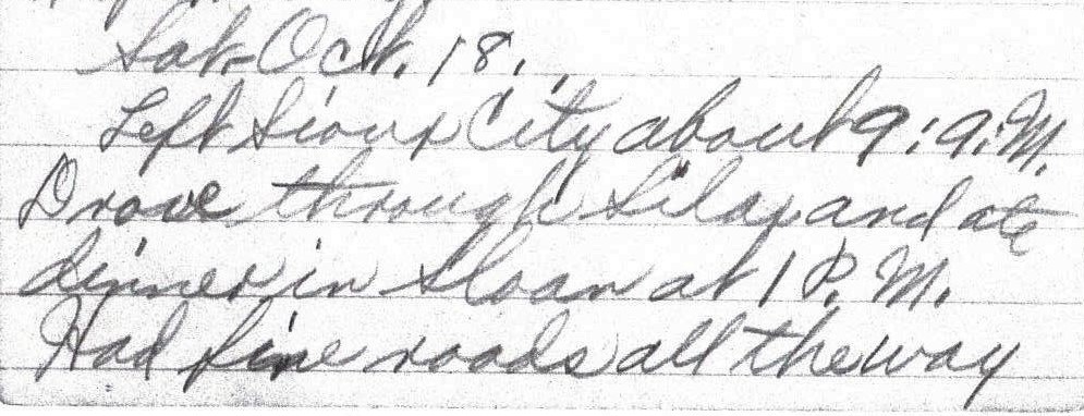
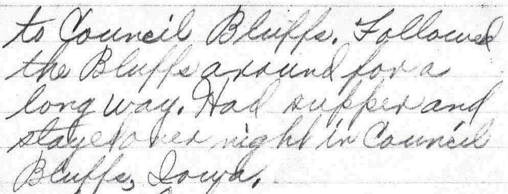
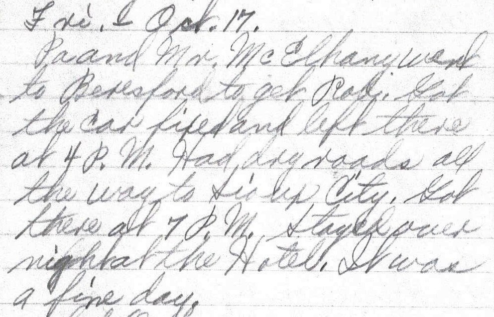
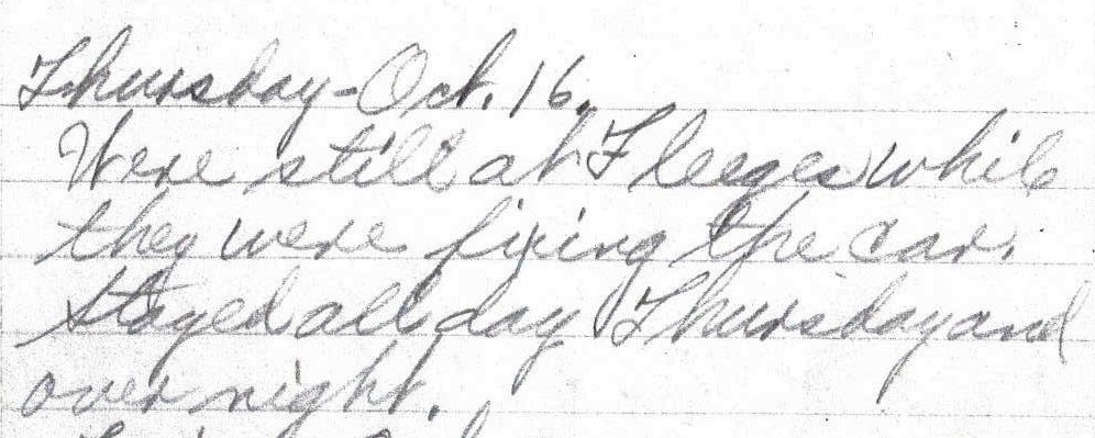
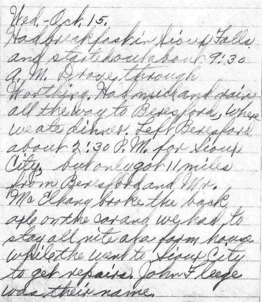
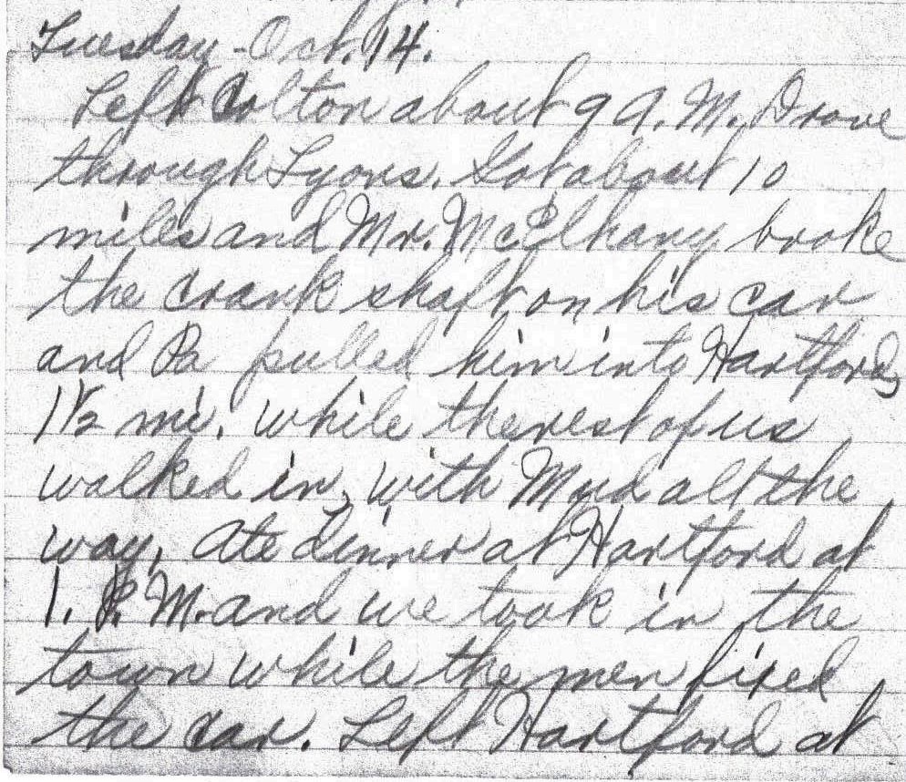
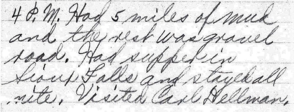
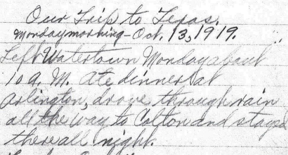
Sun. – Oct. 19.
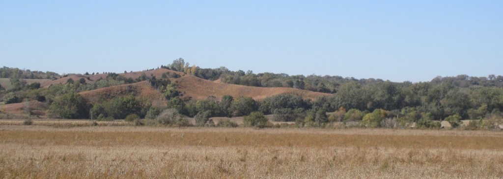
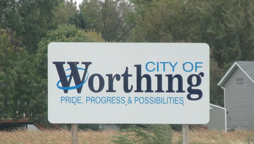
Left Council Bluffs about 8:00 A. M. Had fine roads. Ate dinner on the roadside. Got into Auburn, Nebr. about 5 P. M. and stayed all night. Had supper here. – Lena Bevers
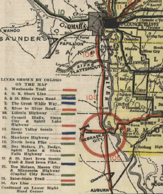
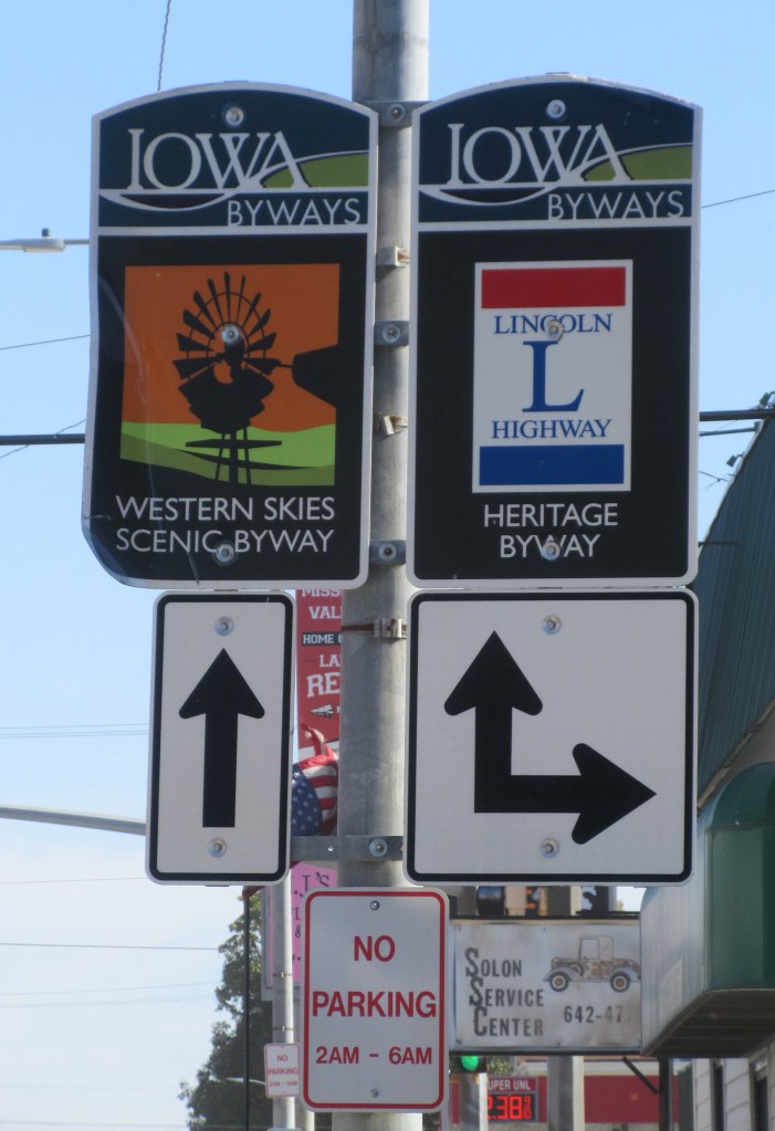
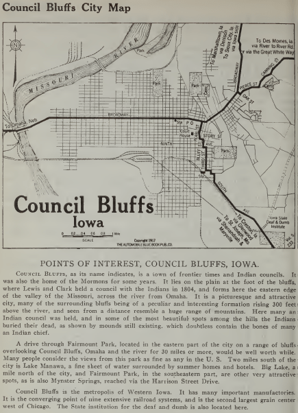
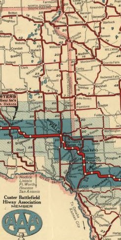
On this day one hundred years ago, Lena only recorded their starting and ending points. This isn’t much information to determine the route that they took on this day. Council Bluffs is on the east side of the Missouri River and Auburn is on the west side of the river, so one question is: Where did they cross the Missouri River? They could have crossed from Council Bluffs into Omaha, or they could have traveled south and crossed at Nebraska City. To make the choice, initially I referred to the Map of Iowa Showing Principal Automobile Routes, dated 1919, which I obtained from the Iowa Department of Transportation website. A portion of the King of Trails Highway is highlighted on this map, indicating that the highway crossed the Missouri River at Omaha and traveled south through Plattsmouth, Nebraska City and Auburn.1 So that is the route that I chose. Just a couple weeks ago, when my mother obtained from her cousin a copy of Florence Bevers’ travel log, we found confirmation that Herbert and Mr. McElhany did follow the King of Trails Highway into Omaha and then traveled south. Florence wrote: “Left Council Bluffs, ate breakfast on our way, same as always, about 8 am. Had fine roads. Drove thru Omaha, Albright, Ft. Crook, Plattsmouth, Murry, Union, Wyoming and Nebraska City. Ate dinner on the roadside. Got into Auburn, Nebraska about 5 pm and stayed all night. Stopped early so they could fix the car.”2
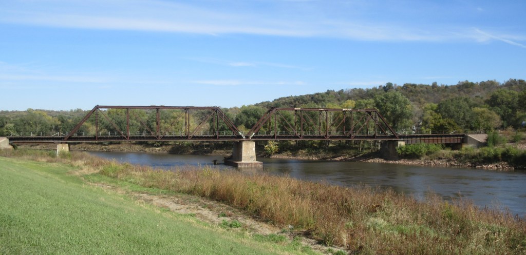
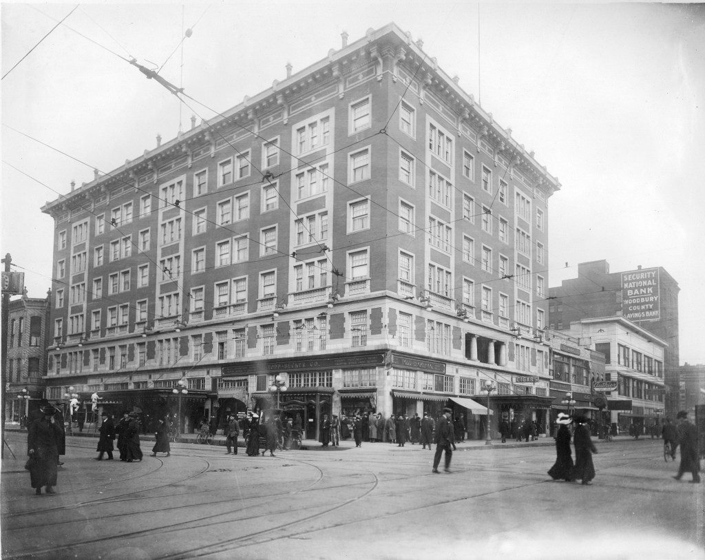
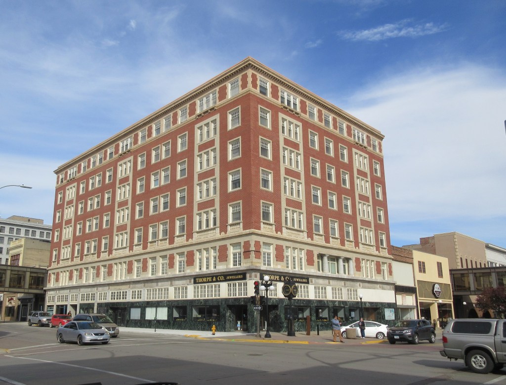
The bridge they would have used was one that between 1913 and 1930 was called the Lincoln Highway Bridge, which was a toll bridge. At the end of Lena’s travel log, she notes that they crossed four toll bridges. The King of Trails and the Lincoln Highways both crossed the Missouri River on the Lincoln Highway Bridge. Originally this bridge was called Douglas Street Bridge. It was a truss bridge built by Omaha and Council Bluffs Street Railway Company in 1888, designed to handle streetcars. On the photograph below, note the signs on each side of the bridge with the capital letter L. These were the signs posted to indicate to the motorists that they were on the Lincoln Highway.
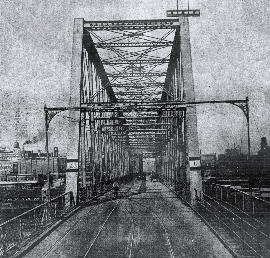
In 1938 a group of businessmen called the Knights of Ak-Sar-Ben (by the way, read this word backwards), bought the bridge with the intentions of making it a free bridge, which they accomplished in 1947.4 The bridge which was then named the Ak-Sar-Ben Bridge served the two cities until November 1966 when the Interstate Highway 480 Bridge was opened. All that is left of the Ak-Sar-Ben Bridge is an east pier near the east bank of the river, south of the I-480 Bridge.
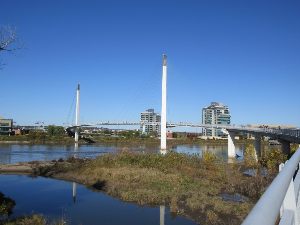
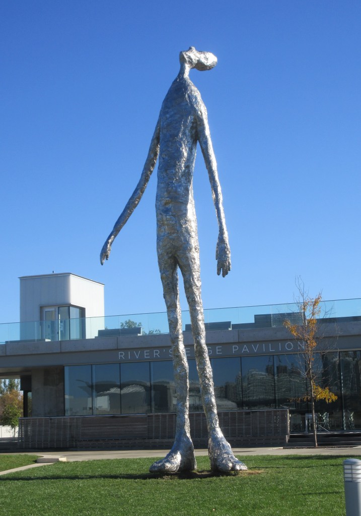
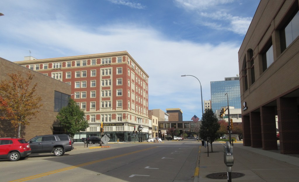
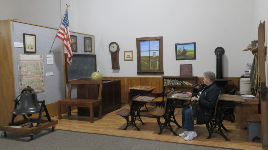
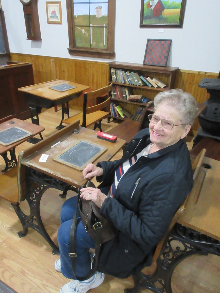
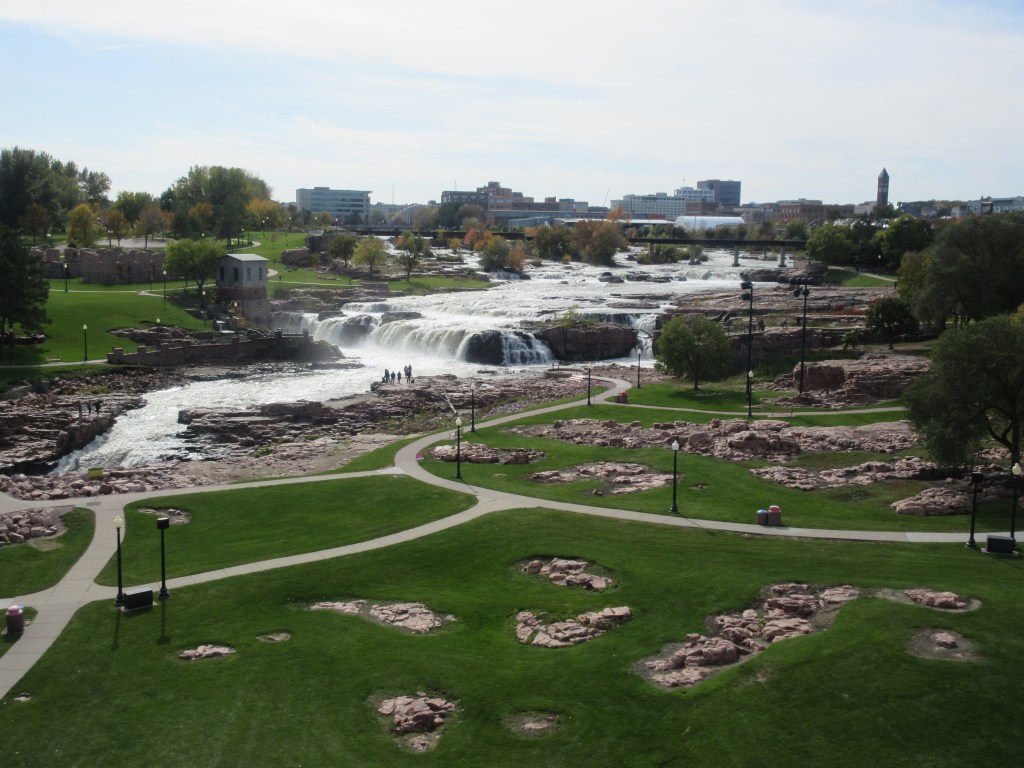
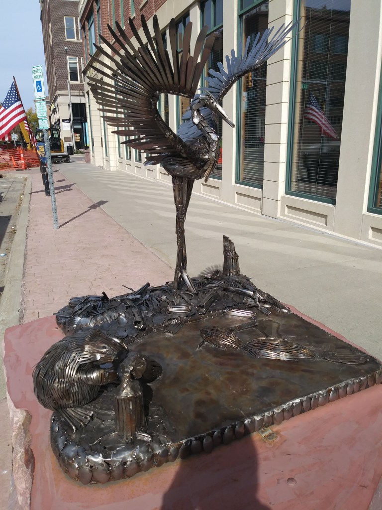
The first thing my mother and I did this morning was drive to River’s Edge Park in Council Bluffs. It was a lovely morning and very pleasant for walking partway across the pedestrian bridge that spans the Missouri River and viewing the motivating statue that stands in the park.


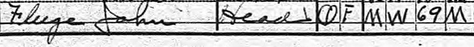
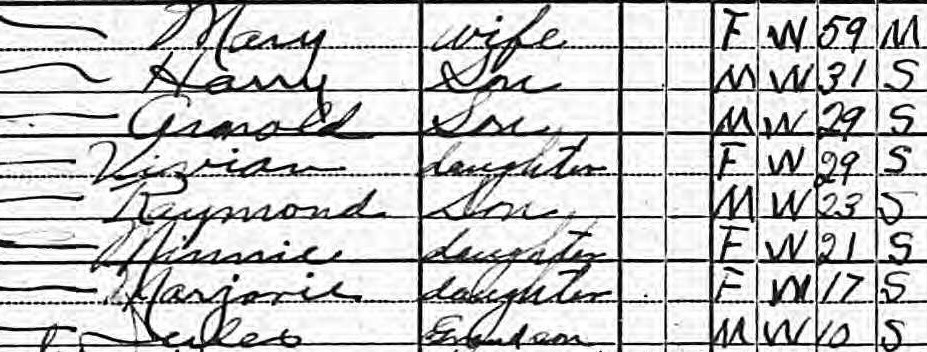
Herbert and Lena’s daughter-in-law Gladys Daily Bevers was born in Omaha. Gladys’ mother Maggie Bonewitz Daily moved with her parents to Omaha from Fairfield, Iowa in 1880 and her father Charles Daily, who worked his way west from Indiana, arrived in Omaha about 1888. Charles and Maggie married in 1891 and except for a short stint of farming near Topeka, Kansas they stayed in Omaha until 1915.
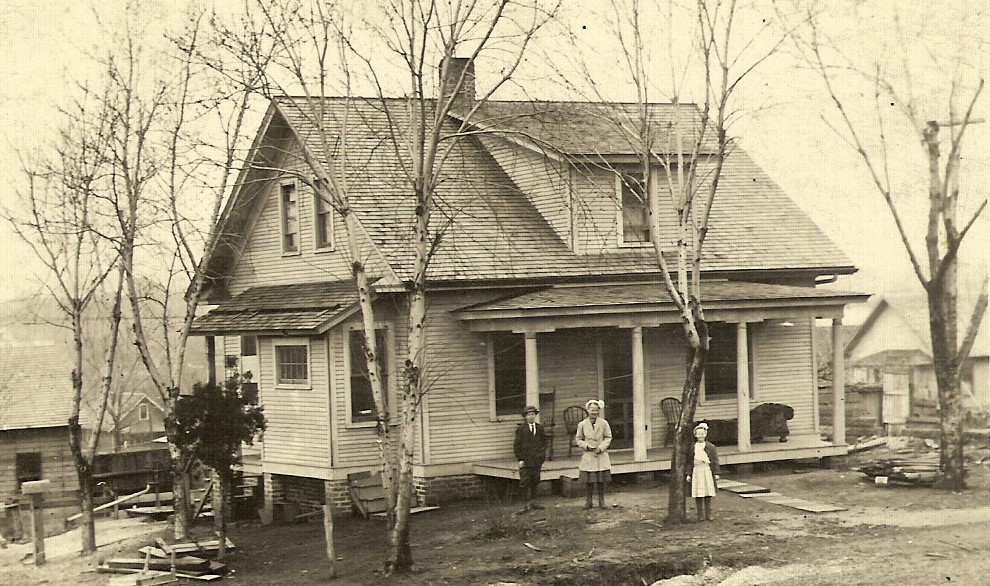
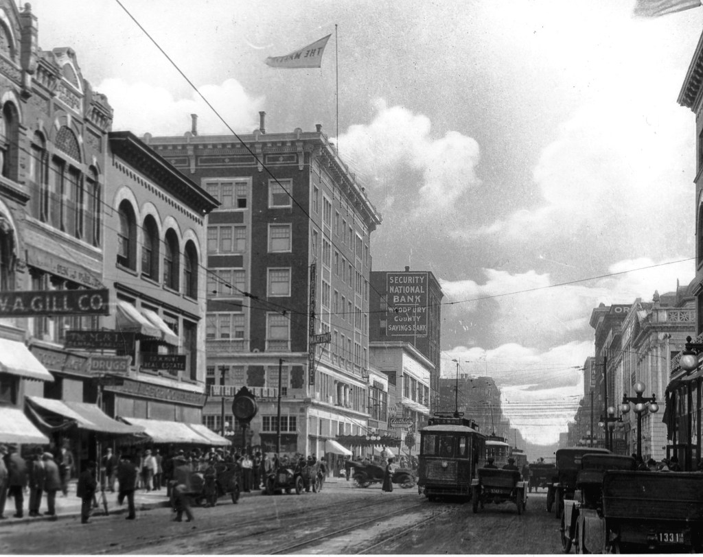
On Easter Sunday in March 1913, there was a devastating tornado that swept through Omaha and destroyed hundreds of homes. Today, my mother and I did some research in the Omaha Public Library and found an article in the Omaha World-Herald that confirmed that the home of Gladys’ grandmother, Josephine Bonewitz, was destroyed.5 Charles and Maggie’s home, two blocks away, was also destroyed, although they were not living in it at the time. Their son Robert has related that they had returned to Omaha from Kansas ten days before Easter and were waiting to move into their house at the beginning of the next month.6 Robert also explains that following the tornado, his father and Maggie’s brother H. Finley built a cottage for Josephine and a house for the Dailys. A year after the tornado, the Daily home was photographed at the same address as their
former house, so it may be concluded that this is the re-built home. In 1915 the Daily family moved to a farm north of Watertown, South Dakota.
In 1919 upon entering Nebraska, the speed law was: “Reasonable and proper; not to exceed 25 miles per hour in any case, 12 miles in the city limits, 8 miles at an intersection, bridge, etc.; at intersection of streets in city, 6 miles.”8 In Omaha the Lincoln Highway broke away from the King of Trails Highway, traveling west toward Cheyenne, Wyoming, while the King of Trails Highway turned south to travel along the eastern border of Nebraska. Today when we left Omaha, we traveled alongside U. S. Highway 75 for about 10 miles. Then we had to get on U. S. Highway 75, which at that point was a modern four-lane highway. Then from Murray to Nebraska City it became a two-lane highway.
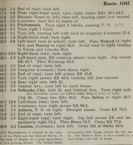
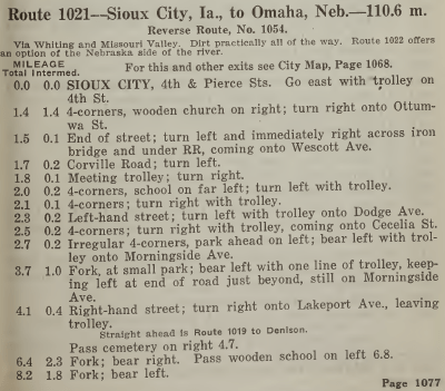
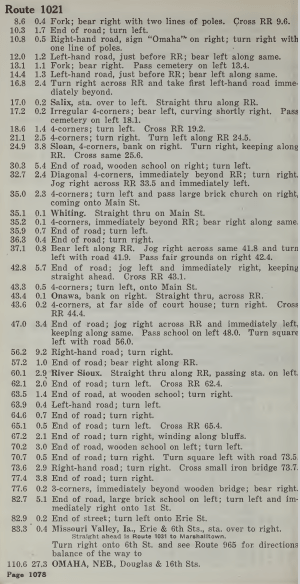
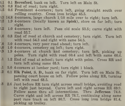
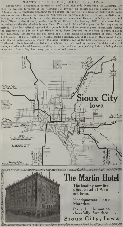
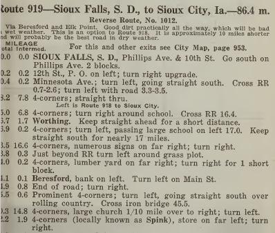
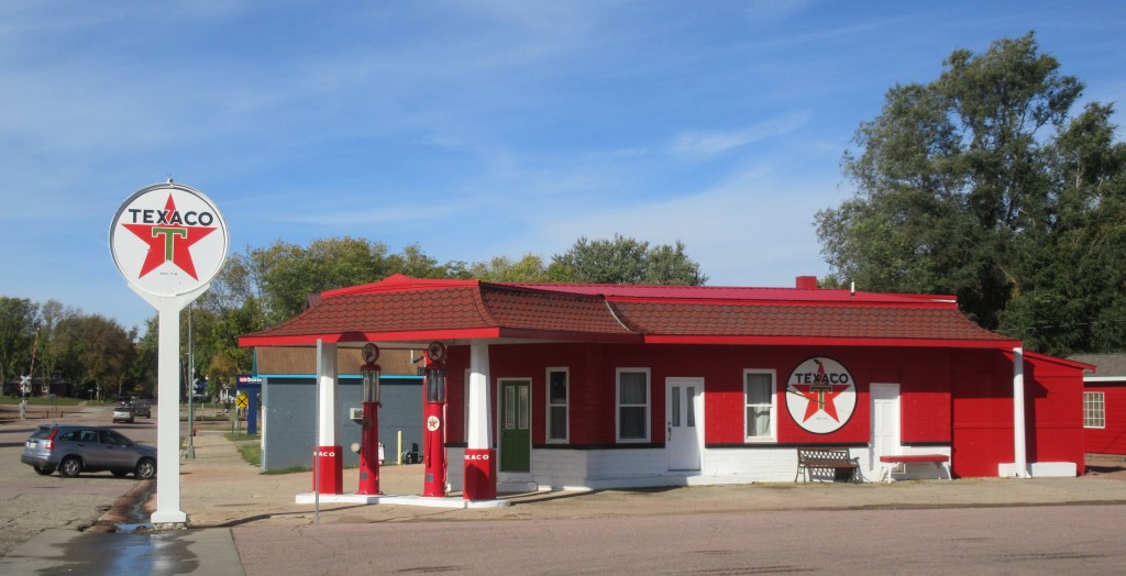
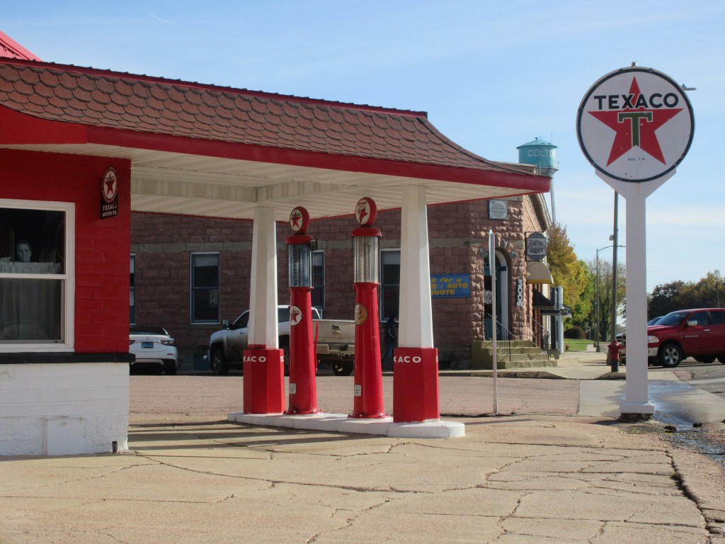
Route 1041 from The Official Automobile Blue Book takes one from Omaha to Hiawatha, Kansas. Lena’s family stopped for the night at Auburn which is at mile 68.7 on this route. In the introductory explanation, I would interpret the “natural roads” to be dirt roads.9 Also, the “Blue Book car” could be equated with the current day Google Maps car.
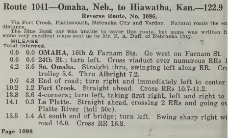
The above directions (from the 1917 Blue Book) say that there was a toll of 50 cents to go over the Platte River10, but the 1920 Blue Book states that the cost to cross the toll bridge was 25 cents for the car and driver and 5 cents for each additional passenger.11 At the end of Lena’s travel log, she adds a postscript, saying that they had driven over four toll bridges. It appears that on this day, they traveled over two of the four toll bridges: the Lincoln Highway Bridge and the Platte River Bridge.
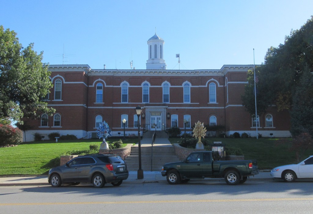
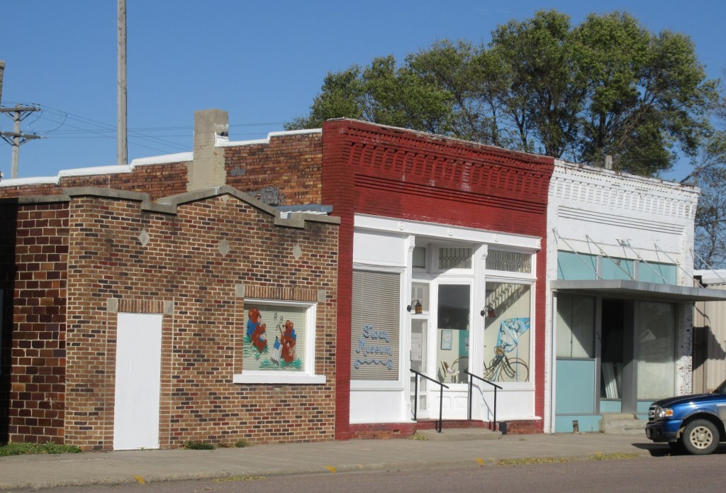
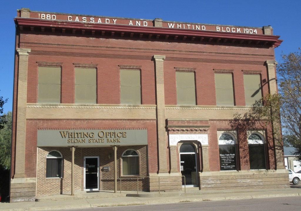
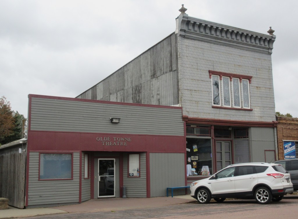
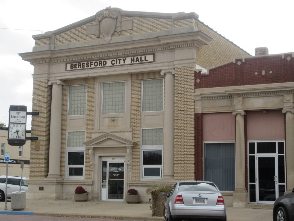
When my mother and I were looking online for a motel, we could not locate one in Auburn. The most economical one we found near Auburn was in Percival, Iowa. So, today we ended our day at 4:30 PM in Percival, instead of traveling as far as Auburn. Before going over the Missouri River to Percival, we decided to stop in Nebraska City for dinner (our end of the day meal). While we were looking for a restaurant, we passed the courthouse, which was erected in 1864. Nebraska City is one of the towns in Florence’s list of towns that the Bevers family passed through. She also notes that they: “Stopped early so they could fix the car.”12
Notes:
- The Kenyon Company, Map of Iowa Showing Principal Automobile Routes (Des Moines, Iowa: The Kenyon Company, 1919), https://iowadot.gov/maps/msp/pdf/historic.pdf.
- B. Winkelmann, Our Trip to Texas [Transcription of Our Trip to Texas by Florence Bevers, 1919] (unpublished, n. d.): 2.
- Omaha Daily Bee, Douglas Street Bridge (Omaha, Nebraska: Omaha Daily Bee, 1914 July 12), https://commons.wikimedia.org/wiki/File:Douglas_Street_Bridge_-_July_1914.jpg.
- Ak-Sar-Ben Bridge, https://en.wikipedia.org/wiki/Ak-Sar-Ben_Bridge.
- Morning World Herald, Homes Destroyed, Not Previously Reported (Omaha, Nebraska: Morning World-Herald, 1913 March 29): 6.
- R. Thiele, Robert L. Daily Interview, recording (ca. 1982).
- 16th Street, North from Harney, Omaha, Neb., http://www.mygenealogyhound.com/vintage-postcards/nebraska-postcards/NE-Omaha-Nebraska-Sixteenth-Street-looking-North-from-Harney-Street-vintage-postcard-photo.html
- Automobile Blue Book Publishing Company, The Official Automobile Blue Book 1917, vol. 5 (New York: Automobile Blue Book Publishing Company, 1917): 1235, https://ia800405.us.archive.org/15/items/case_gv1024_a92_1917_vol_5/case_gv1024_a92_1917_vol_5.pdf.
- Automobile Blue Book Publishing Company, The Official Automobile Blue Book 1917, vol. 5: 1098-99.
- Automobile Blue Book Publishing Company, The Official Automobile Blue Book 1917, vol. 5: 1098.
- Automobile Blue Book Publishing Company, The Official Automobile Blue Book 1920, vol. 7 (New York: Automobile Blue Book Publishing Company, 1920): 162, https://ia601208.us.archive.org/26/items/case_gv1024_a92_1920_v_7/case_gv1024_a92_1920_v_7.pdf.
- B. Winkelmann, Our Trip to Texas [Transcription of Our Trip to Texas by Florence Bevers, 1919] (unpublished, n. d.): 2.


